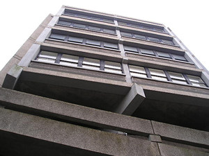
Stonebow and HungatePhotographed in March 2004 |
|
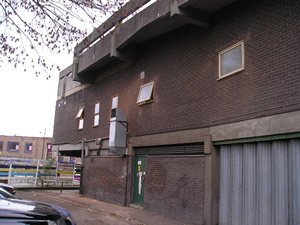
The Stonebow building: "a piece of architecture crudely designed in the
'New Brutalism' style of the late 1950s" |
|
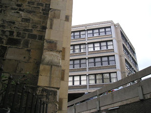
The image above was taken from what is, I guess, the back of the building, looking up. It's certainly striking, this building. The street I was standing in is called Hungate. I only recently realised it had a name. I just thought of it as 'the back of the Stonebow'. The photo left shows Stonebow House as it appears from the corner of St Saviour's Church in St Saviourgate, where Hungate joins it. St Saviourgate is a street of attractive buildings, so meeting Stonebow House at the end of it is quite a shock. |
|
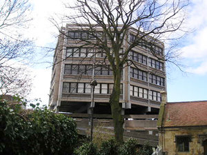
David Lloyd, quoted above, also said: 'there is no doubt that seen from Stonebow, without the contrast of older, gentler buildings, the effect of this deliberately brutal piece of multi-storey concrete-built development is impressive.' I didn't get a photograph from the angle he suggests, but I did take a few more photos from the back of St Saviour's Church (the ARC), on a later date. It looks better with this tree in front of it, which when it's in leaf maybe hides most of it from view in the summer (and was possibly even planted for that purpose). |
 |
 |
Another building at the end of St Saviourgate is overshadowed by the Stonebow – The Central Methodist Church. The noticeboard at the front of the church included this old photograph of the building before the construction of the Stonebow right in front of it, though work seems to be in progress. I can't credit the image as I don't know who took it. Presumably someone who wanted to record just how impressive the building looked when it was visible from a distance, before Stonebow ruined the view. |
|
C B Knight describes the area at around the same time the photo above was taken: 'Immediately on passing St. Saviour's Church we come to
an opening, once a street, which now leads to a wilderness; a wilderness
with not a single oasis remaining in it, except perhaps in the gardens
of memory of some of York's older citizens. The district had degenerated
in recent years into a slum area with no redeeming features, and its clearance
was a worthy civic undertaking. All its medieval features long ago disappeared.' Unfortunately I don't have a record of what Mr Knight thought of the building then constructed here in place of the "wilderness". My mother, though, remembers the reaction to the building of the Stonebow: "There was uproar". |
|
 |
This is Hungate looking back up towards St Saviour's Church. There's also a street called Hungate a bit further along Stonebow on the other side. It took me a while to understand this, until I read that Hungate originally was a winding road, and that the street of Stonebow, constructed in the 1950s/60s, cut through the middle of it. It presumably cut through the bendy bit, which is why the other half of Hungate is not opposite the first part across Stonebow. |
|
 |
 |
|
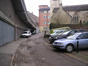
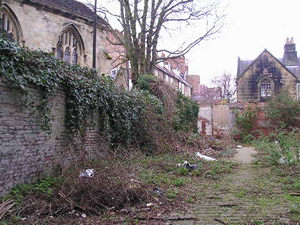
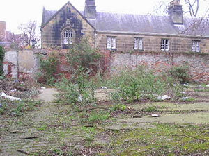
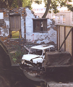
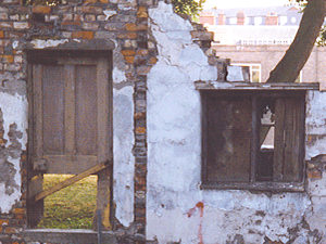
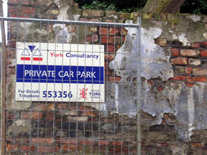
There's a derelict area here, shown above, just behind the church. Lady Hewley's Almshouses are visible in the background. In 1990, I took the photo below, of the same area. The photo seems to have been taken from inside the churchyard, looking over the wall (shown on the photo above left). Within what is obviously the remains of a house, with a door and windows still visible, are the sad rusty remains of cars. In the last fourteen years, the cars have been cleared, but the area is still derelict. |
||
 |
 |
|
|
C B Knight writes: 'Centuries ago this street of Hungate ranked as one of York's important thoroughfares, where its wealthiest merchants resided.' No wealthy merchants here now. Just concrete and cars. |
||
 |
 |
|
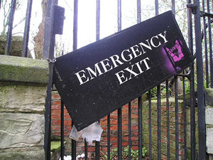 |
I've found the emergency exit. Let's get out of here.
|
|
|
Related pages: St Saviourgate (revisited) for rather more attractive views, including some from the other side of the gate shown above. Also York Walks /3: Somewhere over the Stonebow, for views of nearby buildings from an interesting perspective. |
||
|
|