


10 July 2005
Old stones
This part of the walk took us past the remains of buildings made by previous
generations. Putting this page together, I have in mind a line from T S
Eliot’s Four Quartets – ‘old stones that cannot
be deciphered’.
For route information and background, see the foot of
the page.
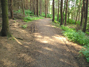
The path around the edge of the reservoir, though through a wooded area, wasn’t quite as pleasant as the path around Fewston, because of the rather monotonous coniferous planting. I’m beginning to appreciate the particularly interesting nature of woodland planted with native trees, where different species support different types of wildlife, and birch, oak, ash are all mixed together. Far more interesting. Still, this path was a pleasant walk.
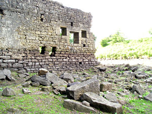
We
diverted from the path again to have a look at this derelict building, mentioned
in the Yorkshire Water route guide. Indeed, we were on the lookout for it,
as there’s something compelling about remnants of old abandoned buildings.
Or is it just me. Anyway, this is an old mill, once part of the village
of West End.
In succession
Houses rise and fall, crumble, are extended,
Are removed, destroyed, restored, or in their place
Is an open field, or a factory, or a by-pass.
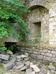
There’s
not much left standing, and only one main wall is accessible. The empty
window spaces frame views along the valley, where the reservoir continues.
It did have an air of melancholy about it.
My research suggests that the
mill became derelict as a result of the failing textile industry, long before
the village was flooded.
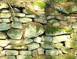
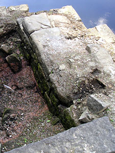
The
walk was then rather uneventful for a time, while we walked through the
conifer trees, and were at times plunged into almost total darkness by their thick overhead canopy. Spooky. At one point there was however enough light for me to photograph this beautiful stone wall, which nature has decorated with a licheny, mossy bloom, and a strange and lovely bluish tint.
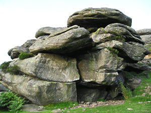
Much further on, after we leave the wooded area and start climbing upwards, I’m expecting to see a lot of ramshackle huts, runner bean poles and areas planted with vegetables in rows. The route guide said we had to look for Roundell’s Allotment. It appears that either this large rock formation, or the area around it, is ‘Roundell’s Allotment’, and that it’s got nothing to do with allotments as I know them. This rock reminds me of Brimham Rocks, where I used to go a lot as a child with my parents. I think it’s somewhere around here, but I can’t be sure as I’ve completely lost my bearings.
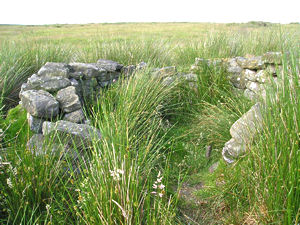
Even more stones, this time a dry stone wall created in a round formation. Perhaps indeed these structures have given the area its name. This structure is obviously no longer used, but blends gracefully into the landscape on this high ground. Apart from not knowing what these round constructions were for, we also couldn’t identify the interesting birds that kept flying overhead with a distinctive call, so we were feeling like stupid townies (and not for the first time).
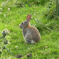
I
can however identify this. It’s a rabbit.
There were suddenly a lot of rabbits around as we started to descend the
hill, and evidence of lots of warrens. Most of the rabbits hopped off, no
doubt as a result of my shrieking ‘Oh look! A rabbit! And another one!’,
but I managed to be quiet and still enough to get a photo of this one.
Thank you for adding a comment. Please note that comments are moderated, but should appear within 24 hours.