


10 July 2005
To Thruscross Dam
The reservoir comes back into view, and the walk finishes at the impressive
dam.
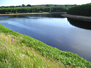
In case you were wondering where the reservoir had gone, as our walk did take us away from it for a while, don’t worry, it’s still here, and it’s still got plenty of water in it. Note conifer trees on the opposite bank – where we started our walk.
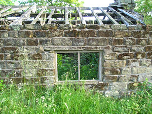
As
we’re leaving the reservoir boundaries, there’s another ruined building.
This one seems to have been someone’s house. The roof timbers are still
there, hanging on, but the rest of the roof is gone, and so nettles and
other weeds are growing not only around the house but inside it too. This
place seems even more touching than the derelict mill.
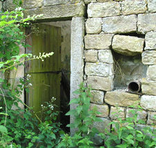
Round
the back, through the weeds, there’s a door that hasn’t been used for a while, though it’s left open still. Strangely, though no one has lived here for years, I felt like I was intruding, and like someone did still live here, and so I returned to the path.
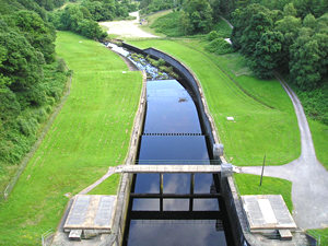
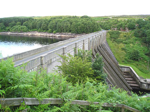
After
walking along the road for a while, we cross the top of Thruscross Dam.
This photo shows the view from the road across the dam, on the opposite
side from the reservoir. The dam we saw previously, at Fewston
Reservoir, was a Victorian construction, all curved and elegant. This
dam, built in the 1960s, is more angular, and made of concrete (did anyone
build anything in the 60s that wasn’t made of concrete?) This view though
is attractive, with the green of the rest of the valley around this modern
intrusion on the landscape.
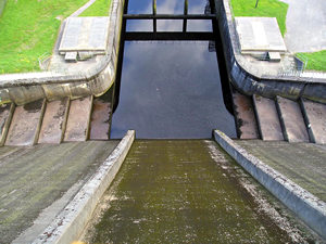
Leaning over the edge to take this photo, I was struck by the pleasing symmetry, though the access paths to either side are slightly asymmetrical in design. I’m also reminded of a splendid song by an American band called Sugar, about ‘standing on the edge of the Hoover Dam’. A quick check on the web confirms my suspicions that the Hoover Dam is a bit larger than this one . . .
Leaving the road across the dam we climb some steps back to the car park.
From the steps it’s suddenly clear what weight of water this dam is holding
back. On this side, there’s a massive drop, with a small stream at the bottom.
On the other side, all that water, held in by that thing I’ve just walked
across. Blimey.
Thank you for adding a comment. Please note that comments are moderated, but should appear within 24 hours.