By the Foss – 1990 and 2004 |
|
While putting these pages together I've discovered one set of photographs I took back in 1990. These show areas around the Foss, and the Hungate area between Stonebow/Peasholme Green and the river. As I've recently taken similar photographs from very similar points, I thought I'd compare the views. The quality of these photos isn't particularly good, but they can all be enlarged by clicking on the image. |
||
1990 |
2004 |
|
 |
|
|
|
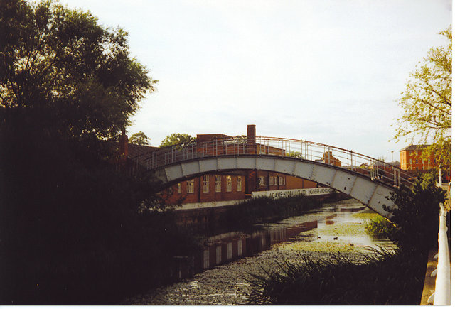
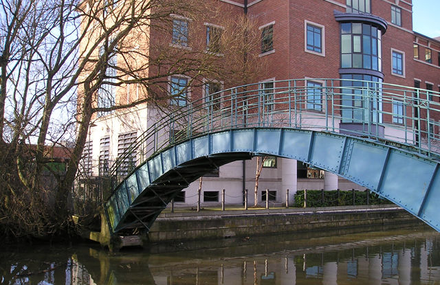
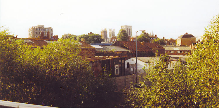
Above, left, taken in summer 1990, at almost the same point by the Foss as the photo (right) taken in January 2004. The 1990 photo shows the bridge painted grey, with low buildings behind it on the side of the Foss, with a sign reading 'Adams Hydraulics'. In 2004, the office buildings constructed since, originally MAFF, now DEFRA (government department, with a modernised name), and the bridge painted in a rather attractive shade of blue. Note that when the riverside buildings change, the reflections in the water change too. The photos below were taken from Rowntree Wharf, 14 years apart. When I visited this year I'd forgotten about these earlier photos, so the similarities of chosen view are a happy coincidence. Though it's summer in the 1990 photos, and winter in the 2004 ones, I think that it's obvious, whatever the season, that this isn't the most attractive area of the city. Plans for its redevelopment are currently being considered. The redevelopment will, of course, be mainly housing. |
||
1990 |
2004 |
|
 |
 |
|
|
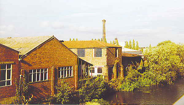
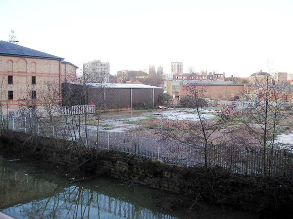
Warehouses, summer 1990, by the banks of the Foss, between the river and Peasholme Green. |
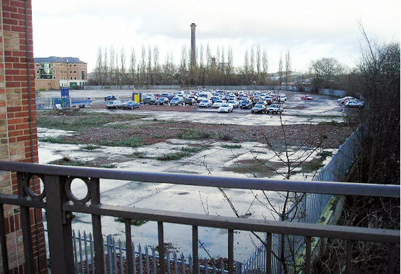
Now cleared of buildings. The chimney of the incinerator on Foss Islands Road is still visible in the background. |
|
 |
 |
|
|
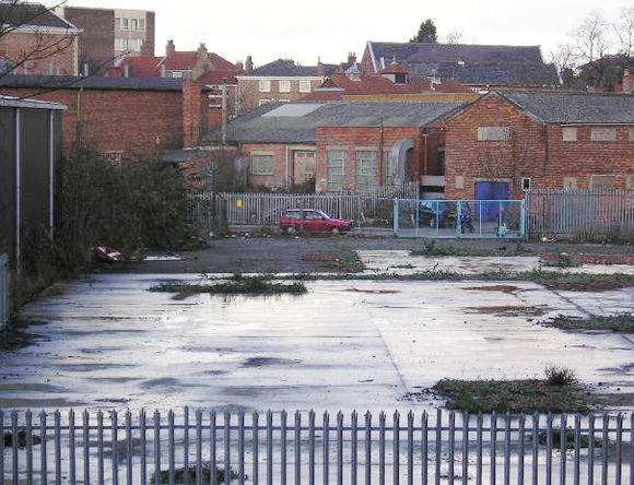
Again from Rowntree Wharf, looking over the Hungate area. The buildings have been cleared. The Minster and Stonebow buildings are visible on the horizon. The area shown in these photos also features in York walks /1 – Ripe for redevelopment. |
||
 |
 |
|
|
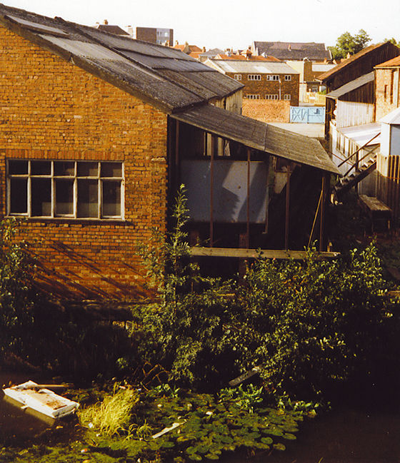
Possibly rather ramshackle buildings, on the banks of the Foss. |
All gone now – leaving more empty space for temporary car parking. |
|
 |
 |
|
|
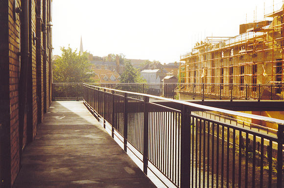
The walkway along the side of Rowntree Wharf. Note that in 1990 the building on the right is obviously under construction. |
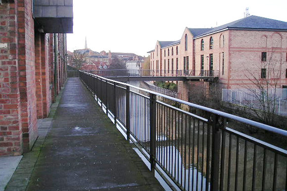
The same view, in January 2004. The building is of course completed, and is a car park. The spire of St Mary's on Castlegate is visible on the horizon. |
|
|
|