St Olave's School to St Olave's ChurchPhotographed in July 2004 |
|
|
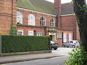
This used to be Queen Anne's School – a local authority establishment – at the bottom of Queen Anne's Road. It's still at the bottom of Queen Anne's Road, but the building now houses St Olave's School, an "independent" school, the junior part of St Peter's. This is handy if only because it makes a nice heading for this page. Let's have a wander from St Olave's School (not particularly historic, as far as I know) to St Olave's Church, which is. |
|
|
The school is on the route of an old snicket or snickelway that passes through Clifton and towards town. It is part of "York's longest snicket", mentioned in Mark W Jones' Walk Around the Snickelways of York. This section takes us down a red-brick walled alleyway, under the railway line, past a car park and into Marygate Lane, whereupon we emerge onto Marygate, near the church. |
||
|
|
|
|
|
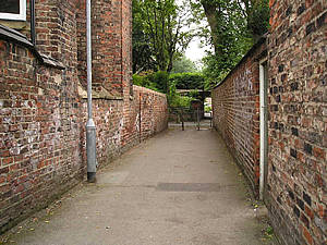
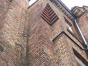
Above: from the school into the snickelway, passing the impressive tall houses of Bootham Terrace – detail above right. As English Heritage notes, in the entries for the listed houses on Bootham Terrace in Images of England: "Nos. 1-22 Bootham Terrace form an unusually complete row of speculatively built terraced houses, constructed between 1860 and 1870 to an interesting variety of different designs". Presumably "speculatively built" around the railway line (see below). |
||
|
|
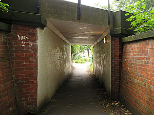
This tunnel passes under the railway line that goes to Scarborough, a North Yorkshire coastal town. The line was opened in the mid-19th century. This tunnel is constantly being decorated with graffiti, and then painted over, and then covered in graffiti again, and then repainted, and . . . you get the picture. |
|
 |
 |
|
|
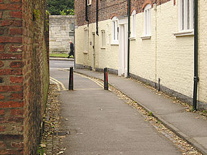
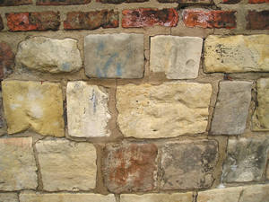
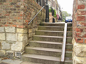
The brick wall to our left as we emerge from the tunnel contains this obviously older section of stone. The steps lead up from here to the street of St Mary's – another of the streets off Bootham containing substantial terraced houses. The view on the other side is Marygate car park. I did take a photo of this, but haven't included it, as one car park is of course very much like another. Despite the lack of a picture, Marygate car park deserves a mention because some of the changes that have taken place here, or been planned, sum up the confusion that seems to be inherent in town planning. The site contained many streets of small Victorian terraced houses, and these were demolished, and while no one knew what to do with it, it was used as a car park. A few decades on – indeed recently – it was going to be used again for housing, because it appears that all we want to do, in the beginning of the 21st century, is cram as many residential properties into York as we possibly can. Maybe it's some kind of experiment, like they do on rats in small cages. In the 1970s, while devoid of houses, the car park was a "clearance area", and featured in the plans for an inner ring road, which would cut across the river, through this area, and up across Bootham. Totally mad, but seriously considered at the time. And that was only 30 years ago. We should all take heed – we have to keep an eye on what the powers that be plan for our cities. Enough of my opinions. Moving on from the houses/clearance area/car park/eyed-up possible residential development that is Marygate car park, back on the route, to the charming Marygate Lane, below. |
||
 |
|
|
|
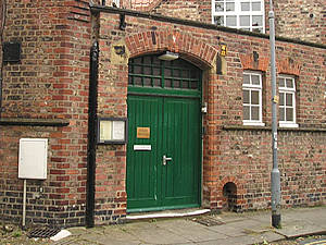
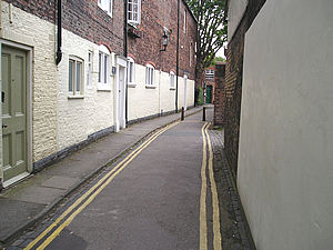
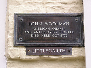
Above, left: St Olave's Church Hall, at the bottom of Marygate Lane, pictured above right, and also below, left, looking the other way, with the church hall just visible at the bottom. This is one of York's many atmospheric narrow lanes, and one of my particular favourites, because it's the beginning of a route that runs through to the Clifton footpaths. The plaque in memory to John Woolman is easy to miss, on the front of one of the houses here in Marygate Lane. John Woolman is buried in the small Quaker burial ground in Bishophill. |
||
 |
 |
|
|
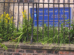
We emerge from Marygate Lane onto Marygate, with the church of St Olave's a little up the road on the left. When I visited Marygate in the winter months, I neglected to take a photograph of the church. Unfortunately the tower is now covered in scaffolding, so I've missed it off the photo. The churchyard is particularly attractive, as the flowers spilling through the railings are near the level of your head as you walk by. Depending how tall you are, of course. They're quite near the level of my head, but then I'm a shortie. |
||
 |
|
|
|
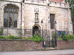
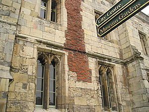
Next to the church is the entrance to the Museum Gardens, photographed in York Walks /1 (winter) and revisited in autumn – York Walks /4: Museum Gardens. This rather impressive old building marks its Marygate entrance. |
 |
|
|
|